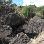
“Welcome to the rocks that Wellington said don’t exist,” she greeted us.
A wiry woman, impressively dressed in a broad-brimmed leather hat and a buckskin vest as if she were still ready for sixties counter-culture happenings, she spoke in a precise, possibly Germanic accent. “But we proved zem wrong!” she chortled.
This was Rita Schaad, co-owner with her husband Felix of the farmland where we were about to tour the Wairere Boulders, close by Hokianga Harbour near the top of the North Island peninsula. Her obvious passion for the place kept her happily talking to us, a willing and bemused audience, for the next fifteen minutes.
We had come with little information about the boulders, though they were mentioned in our NZ guidebook and were highlighted on our Jasons map of the area – a result, Rita admitted, of paid advertising. And apparently the Schaads had little information about the boulders when they originally acquired the property.
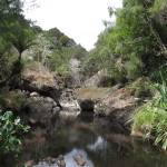
That move was about thirty years ago, when they left their native Switzerland to find a place farther apart from the madding crowd. The acreage they bought offered plenty of farming land and its own water source, which eased down the volcanic hills through diverse rainforest. But the waterway was somewhat unusual, because it but was filled with massive rocks heaped helter-skelter as if tossed by some giant from afar.
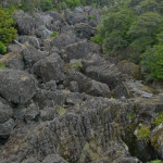
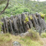
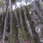
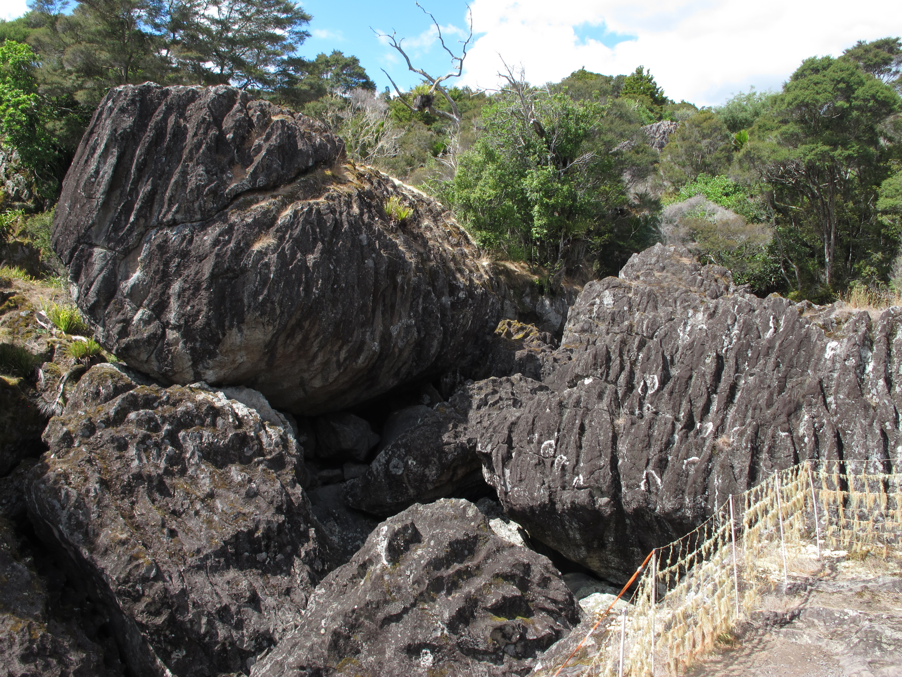
Those rocks are the geologically interesting bits in the midst of otherwise porous clay and volcanic rock. They constitute what remains of a basalt layer, a dense heavy rock that looked to us like a darker form of granite. Even more important – and unique according to the Schaads – is the fluting on many of the largest basalt rocks. As we walked about the property, those fluted boulders exhibited deeply scored striations or channels on their surfaces. We have seen that kind of erosion before, on limestone facades in Australia, for example, and other soft rock faces. But, with basalt, that’s a remarkable phenomenon.
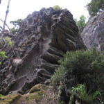
So the Schaads consulted the geological experts at the national government in Wellington. According to those experts, the massive rocks sprawled along their river couldn’t exist in New Zealand. Undaunted by this official denial of the reality in their backyard, they consulted an expert at a university in the States. He became very excited about the boulders, offering a theory about how such hard stone could be eroded in such an unusual way, and proposing he come study them further. Once Wellington heard that news, however, its geologists figured they couldn’t let an American take the lead on this so they came to study the rocks they had earlier declared impossible.
More fully informed of the rarity of what sat on their property, the Schaads began some improvements to open it up to the public. They started these in the year 2000, according to the pictures displayed within the log cabin they use as a visitor center. And they did it all themselves, with no DOC funding or other support. After two or three years, they had cleared trails and posted markers, added several bridges over the boulder-filled river plus a viewing platform high above the terrain at trail’s end, as well as connecting staircases. Fortunately, Felix, an engineer, was able to design and build all those structures. He proudly displays a design blueprint next to one ladder-like stair going up and over a large tree branch across the trail. We thought his bridges quite attractive…and sound structurally as well.
Finally, with the necessary safety approvals, the Schaads opened the Wairere Boulders Nature Park to the public. Perhaps some days they greet the hundreds of people that their car park could hold, but we shared the space with only two other cars on the mid-week afternoon we were visiting. After bending our ears when we arrived, Rita half-apologized for going on a bit, admitting that she could go days without talking to anyone. We figured it was a good day for her, since she had been speaking German with a German couple just before we showed up. “We get a lot of German visitors,” she confided, “but not zo many Americans.”
We were fortunate to have Rita greet us in the log cabin, beguiling us with her glee at the story of the boulders and the Schaads’ role in showing them off, even though she must have told that story hundreds of times before. Not all visitors get that treatment, for Rita and Felix have other work to do – while many visitors are in too great a hurry to move on. But visitors do honor the admission fees apparently, even without her exuberant greeting: at least 90% deposit the admission fees ($15 for adults, less for youth) in the box.
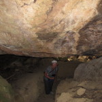
Despite all the many hikes we have done in New Zealand, we were certainly charmed by our trek through the property as well – by the river channel filled with massive boulders, the rainforest, the cavernous passages formed from spaces beneath the largest boulders, the reminders of how to identify the native trees and by those weird fluted rocks.
So how did they happen? According to the general consensus, the striations in those dense rocks were caused by erosion from water streaming down kauri trees, the giants endemic to New Zealand, and drawing with it highly acidic tannins from the wood.
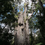
Sadly, most of these mammoth trees are gone now. Kauri trees had been harvested extensively throughout the 19th century and into the 1960s for the strong and straight-growing wood, useful for construction and ship-building, as well as for varnish. Though revered by the Maori, these omnipresent trees were literally decimated in the past by a combination of logging and fires, and even in the present by a mold spread by visitors’ shoes.
So it is rare to find them in great quantities now within the country.
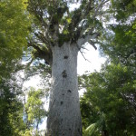
While in the Northland we had the privilege of visiting one area where many of these impressive trees still grow. That’s the Waipoua Forest in the Hokianga region. Here, amid surprisingly large stands of kauri, we could walk to the tallest and oldest of them, Tane Mahuta, dating back 2000 years, as well as the widest, the stubby Te Matua Ngahere (see the video at the end of the article). In the appropriately named Cathedral area, we counted a dozen giants silently gathered about us.
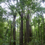
And we saw curiosities like the Four Sisters, four tall trees fused at their base into one mound out of which they now grew, and like a pair of trees fused together in their middle as one tree. Or is it still two?
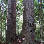
They were all so much more than awesome; they struck true awe in us, a stillness matching that of the trees themselves. And we wondered what this area – and the Schaads’ forest – must have looked like even just hundreds of years ago.
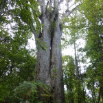
At Waipoua, we noticed how the kauri seemed to grow by heaving themselves slowly out of the ground, so that the base eventually rose over a meter high on a bole of soil and roots.
We could then understand how, at the Wairere Boulders, the multimillion-year-old progenitors of the current kauri could form their deep imprint on those hard basalt rocks. Slowly heaving themselves out of the soil and rock beneath them, they weeped their corrosive tannins down tree, root and rock to carve a memorial for all those kauris that once stood tall in these forests.
—————
A Maori woman sings a hymn to Tane Mahuta:
(Also, for more pictures from New Zealand, CLICK HERE to view the slideshow at the end of the New Zealand itinerary page.)




Awesome blog, thank you very much for sharing it. I am impressed how much you still remember, so obviously I did not talk to a wall. I remember your story how your family name (Taylor) came about. Quite remarkable.
Felix said, just as well he was not there, because who knows how the description of his character would have turned out! Good fun.
Wishing you a great life,
Rita
The Wairere Boulders are indeed magnificent examples of the slow solution of basalt by weakly acidic water, a process that probably takes thousands of years. They are not the only examples of this wonderful landform with a number of other examples in Northland and Auckland scheduled as outstanding natural features for protection in their Regional Policy statements. Karst basalt boulders are also known in Hawaii and are well developed on Norfolk Island where examples have been placed all around the main township of Burnt Pine. A more plausible explanation for the formation of the fluting down the sides of the boulders and for the dissolving of solution basins on the boulders’ upper surface is that it was a result of humic acid seepage from the decay of humus that collected around the roots of plants that grew on top of the boulders under a forest canopy, such as still exists in some places like Stoney Batter, Waiheke Island.
Thanks, Bruce, for adding to the science of the boulders. We will have to look for the same effect in those other spots.